Delivering geospatial, spatial research, and data visualisation to support the development of a 13,600 hectare wind farm in Western Victoria
Tetra Tech Coffey GIS experts are working closely with stakeholders of the Mt Fyans Wind Farm, a site which incorporates 13,600 hectares and 8 landholders and has the Hamilton Highway on its southern boundary and the Mortlake-Ararat Road through its centre.
This new development is planned to be a significant long-term investment in Victoria’s renewable energy generation. This project is now actively being progressed with near future submission of planning permits, selection of WTG providers and other development activities occurring.
Tetra Tech Coffey was selected as a trusted GIS services provider to:
- Work closely with other project consultants as an integral part of the project team.
- Acquire and manage spatial data, including managing land information of property boundaries, titles, easements, and leases.
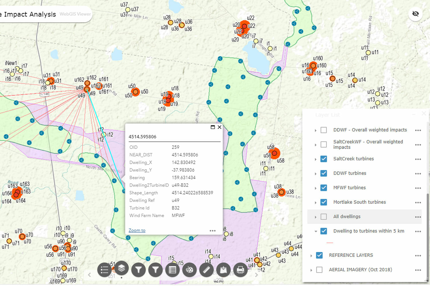
- Undertake spatial analysis and research, including constraint analysis, facilitating collaborative layout development, opportunities analysis and cumulative impact analysis.
- Produce maps and visualisation to aid design and communication with Various stakeholders.
- 3D visualisations for presentations including visual impact assessment and the creation of photomontages in accordance with the Scottish National Heritage Visual Representation of Wind Farms Guidance (2017 SNH Guidance document). Photomontages are a critical communication tool for wind farms. It is an opportunity to accurately express the potential visual impact of the wind farm on the landscape.
Tetra Tech Coffey has built and deployed several WebGIS and field data collection applications, including a ‘Collaborative Layout Development’ (for remote and multi-user data editing and designing), a ‘Cumulative Impact Analysis’ (including impacts from surrounding proposed and constructed wind farms) and a ‘Mt Fyans Wind Farm WebGIS Viewer’ and several ArcGIS Collector maps.

Client name: Woolnorth Renewables
Location: Mortlake, Victoria, Australia
Duration: April 2020- Ongoing
Services provided: Project GIS, Web GIS, Field GIS, 3D visualisation, collaborative wind farm layout development, stakeholder consultation