Delivering geotechnical and hydrogeological services to support upgrades to the Melbourne Metro Tunnel.
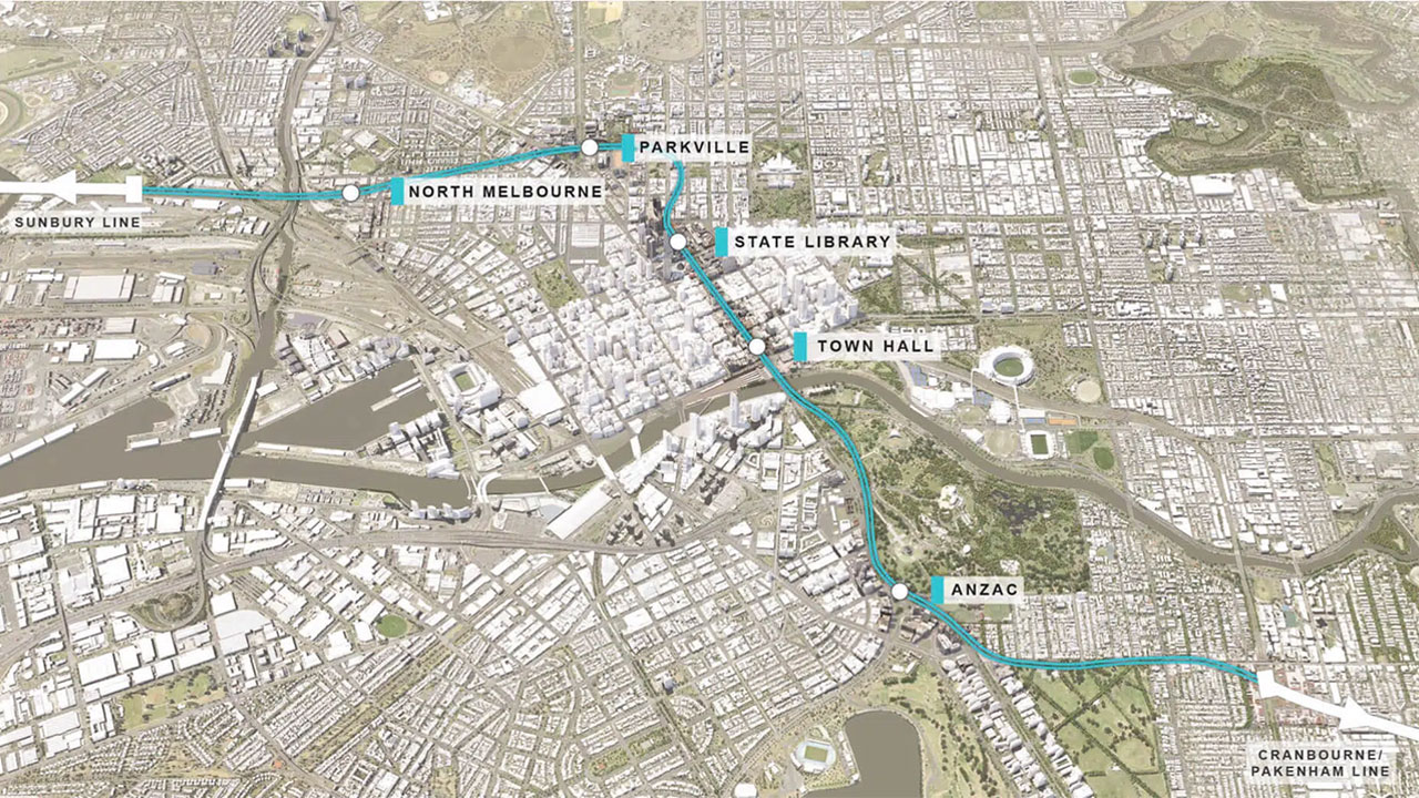
The $11 billion Metro Tunnel project aims to untangle Melbourne’s City Loop network, significantly increase capacity on the whole system and ultimately transform Melbourne’s public transport system into a world-class transport facility.
Our team are were engaged by Cross Yarra Partnership to provide hydrogeological and geotechnical services for this iconic rail infrastructure project, covering 9 km of tunnels, and 5 underground stations.
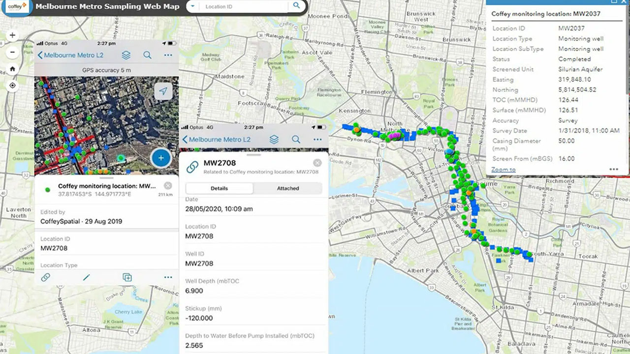
The GIS team underpins this work by managing the project in GIS. This includes investigation location plan-ning, tracking and management; groundwater and soil contamination mapping; and groundwater flow and contaminant plume contouring. The GIS holds data for 1000+ investigation locations and has produced 400+ map products to date.
Groundwater monitoring data is captured on mobile devices in the field via a mobile GIS Collector app, providing real time data to project managers and eliminating the need for office-based transcribing of field notes. This ensures the latest data is always visible and interrogatable by the broader project team.